Places of Natural Beauty in the Tohoku Region
The Tohoku region is an area blessed with majestic natural mountains and nature. Here you will be introduced to four nature spots to visit that are perfect for the green season.
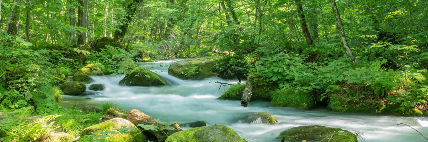
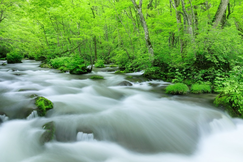
[Aomori Prefecture] Oirase Keiryū (Oirase Mountain Stream)
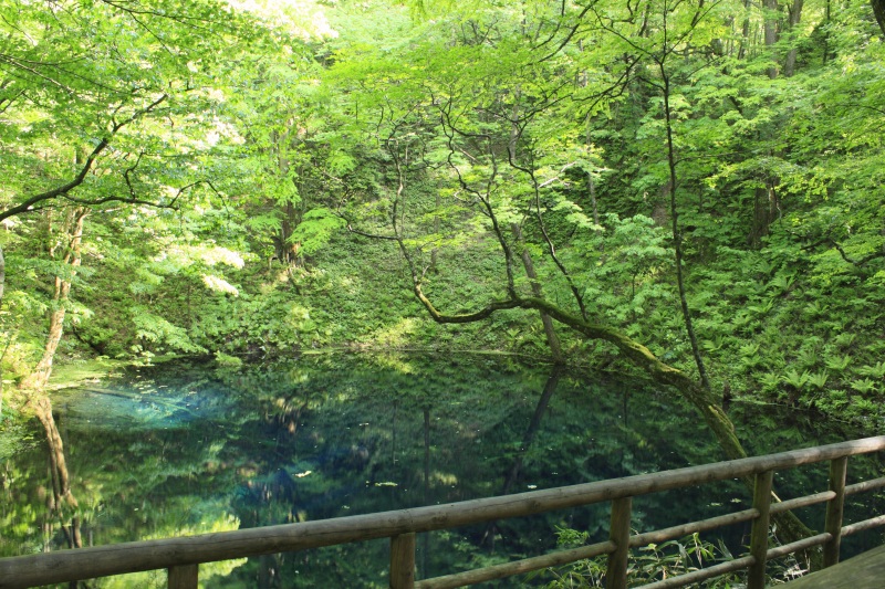
The Oirase Keiryū is a 14-km-long mountain stream with its source in Lake Towada, a lake famous for its scenic and beautiful surroundings. It is the only stream that flows out of Lake Towada.
The stream traverses through a dense forest of mossy rocks, fallen trees, and woodland, morphing into waterfalls, plumes, and gentle clear streams, down an elevation of 200 meters.
Wherever the journey takes you, disover a series of beautiful mountain streams, moss, rocks, and plumes. Be drawn in by this breathtaking and mysterious world.
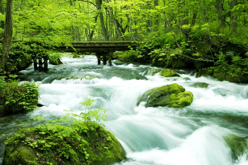
The Three Most Beautiful Mountain Streams in Oirase Keiryū
The 14-kilometer water flow from its starting point at Nenokuchi on the east shore of Lake Towada to its ending point at Yakeyama is divided into three sections: an upper section with a series of dynamic waterfalls, a middle section with a continuous and strong flow of splashing water, and a lower section with a gentle flow.
Here we will introduce the three most popular streams, Chōshi Ōtaki, Ashura no Nagare, and Samidare no Nagare.
If you do not have much time or are not confident about your physical stamina, we recommend taking a bus or driving along the road that runs parallel to the stream.
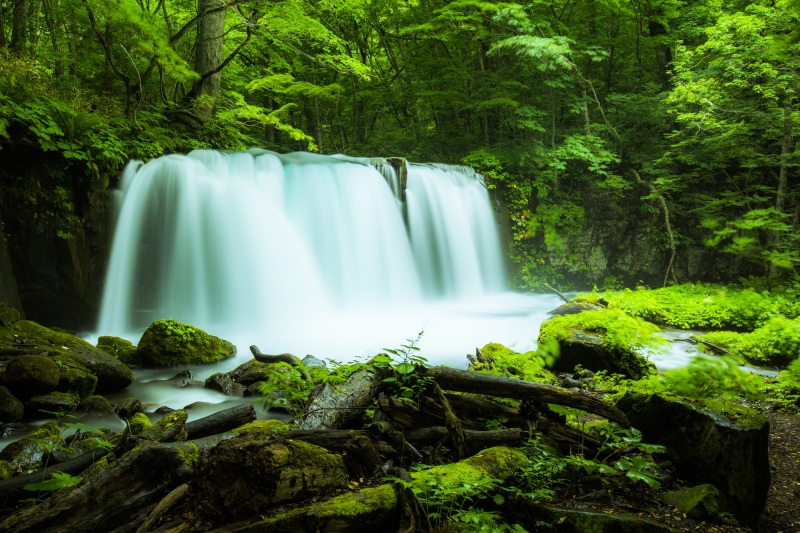
■ Chōshi Ōtaki (Chōshi Waterfall)
Chōshi Ōtaki is the largest waterfall in Oirase Keiryū with a width of 20 meters and a height of 7 meters and is the only waterfall in the river’s main stream. It has become a symbol of Oirase. The waterfall is also called the "fish stopping waterfall" because it rejects fish that try to go up the Oirase Keiryū and enter Lake Towada. Its dynamic, fish-stopping appearance overwhelms the senses.
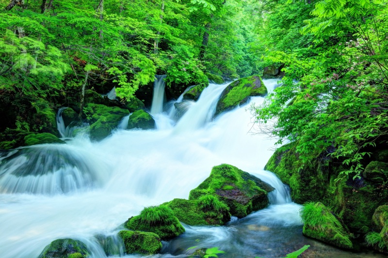
■ Ashura no Nagare (Ashura Stream)
This is the most scenic spot of the Oirase Keiryū, often appearing on posters. The flow here is the most violent, with layers of clear water flowing between moss-covered rocks and creating a white spray. The contrast with the surrounding greenery is wonderful, making it a great spot for photography.
The Unique Charm of Oirase Keiryū
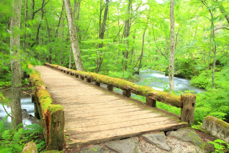
The best part is that you can walk alongside and feel the clear streams and waterfalls of Oirase Keiryū. Since flooding is rare in the Oirase Keiryū and the promenade has been developed safely along the stream, you can enjoy the beauty of the stream up close.
The moss that give color to the beautiful scenery of Oirase are another attraction. Because Lake Towada acts as a natural dam and provides a stable supply of water, the rocks along the stream are not eroded and allow the beautiful moss to grow.
It can be said that the charm of the Oirase Keiryū was created by the wonders of nature.
Column
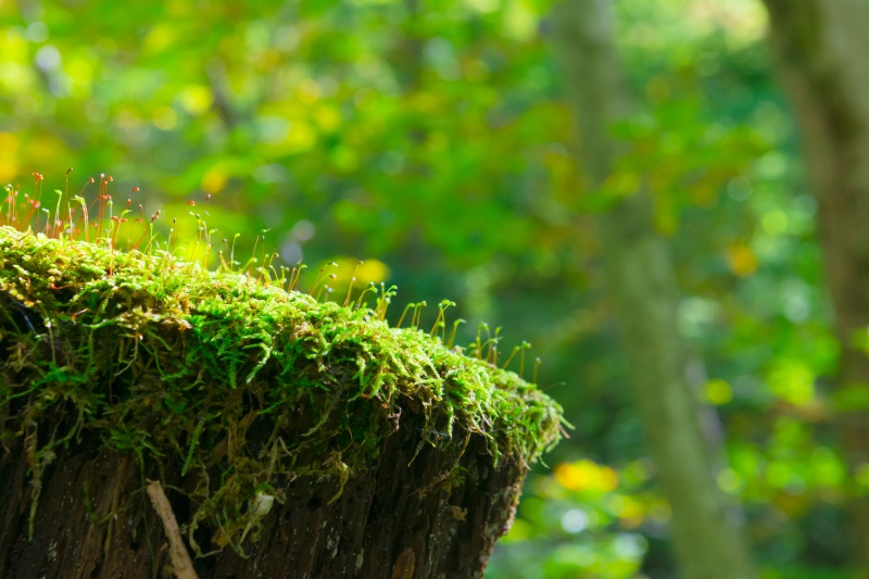
"Koke Sanpo", a popular activity in the Oirase Keiryū
It is thanks to moss that the forest has regrown in Oirase, which was affected by a volcanic eruption in 915 CE. The moss that eventually formed on the rocky ground created the soil necessary for the regrowth of plants and trees, thereby nurturing a rich forest.
From mid-April to early November, the “Oirase Keiryū Moss Walk” is held where you can take a peek into the microscopic world of moss with a nature guide.
If you look through a magnifying glass you can see the story of the birth of the Oirase Keiryū.
[Aomori and Akita Prefectures] Shirakami Sanchi (Shirakami Mountain Range)
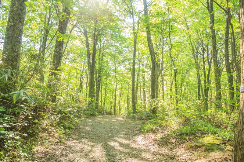
Shirakami Sanchi straddles the border between Aomori and Akita prefectures. It is a general term for a mountainous area ranging from about 1,000 to 1,200 meters above sea level, and covers an area of about 130,000 hectares, which is more than the size of the main island of Okinawa. Of this area, about 17,000 hectares, the core of which is covered with virgin beech forests, is registered as a World Natural Heritage site. The fact that there is such a vast area of virgin beech forest that has not been logged, planted, or constructed is extremely precious in this day and age.
When old trees fall, sunlight shines into the open space, and small young trees sprout from the fallen leaves. This kind of generational change repeated constantly for about 8,000 years, the Shirakami forest has been passed down the generations.
A Mysterious Forest with a Variety of Plants and Animals
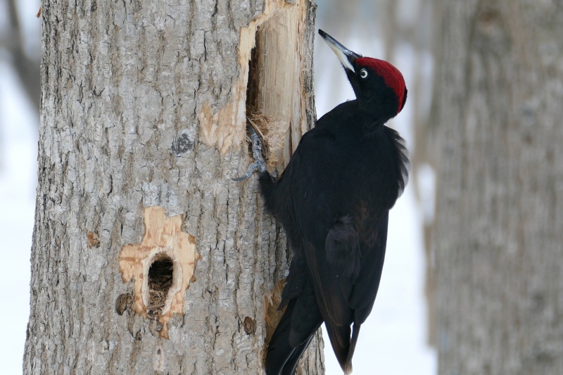
One of the key points that led to Shirakami Sanchi being registered as a World Natural Heritage site is its ecosystem. The beech forests here are rare in the world for their primitiveness and diversity of flora and fauna, also serving as a habitat for endemic and endangered species. The Kumagera, a large bird of the woodpecker family that lives in small numbers and was designated a national natural monument in 1965, is a symbol of the Shirakami Sanchi.
Go for a Hike to Experience World Heritage Firsthand
The area registered as a World Natural Heritage site is divided into a core zone and a buffer zone, and while entry to the core zone is restricted to protect the ecosystem, the buffer zone has trails for beginners with few ups and downs. There are several hiking courses that take about one to two hours to complete, and while enjoying the walk, you can fully experience the charm of Shirakami Sanchi with its giant beech trees and mysterious lakes and marshes. The best season for hiking is from May when the leaves are fresh green to October when the leaves change color.
The Miraculous "Aoike" (Blue Pond) at the World Heritage Site
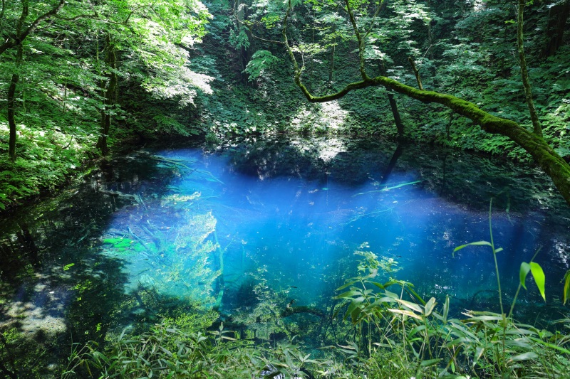
In the western part of the Shirakami Sanchi, there are 33 lakes and marshes collectively called the “Twelve Lakes”. Among them, the "Aoike" (Blue Lake) is the most unique.
The brilliantly clear cobalt blue color is said to look as if blue ink has been poured into it, although the exact color changes depending on the weather, time of day, light, and angle of view. The view of the Blue Pond while listening to birds chirping and feeling the air of the forest is truly spectacular.
Column
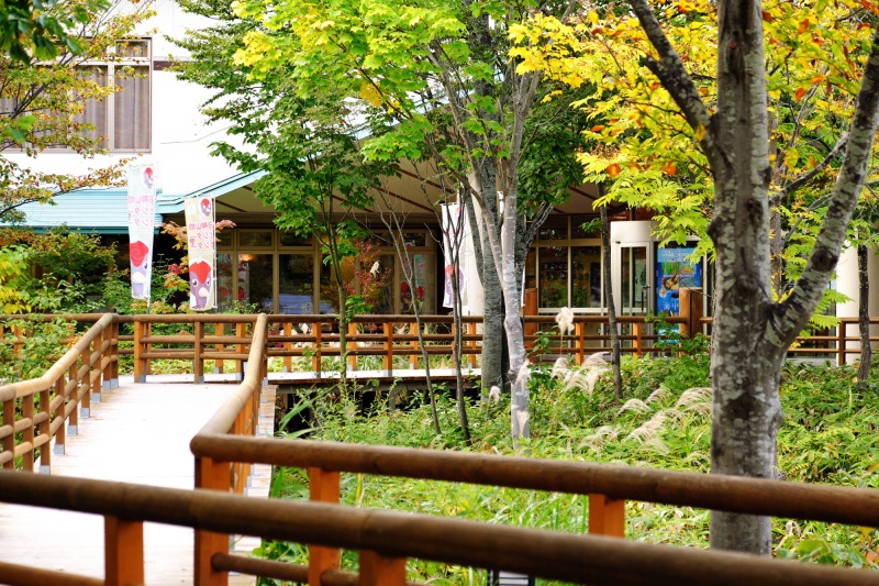
Learn About the Area at the Shirakami Sanchi Visitor Center
The Shirakami Sanchi Visitor Center is a great place to stop by before setting foot into the forest.
The center is in Nishimeya Village, the gateway to the Aomori Prefecture side of Shirakami Sanchi, where you can watch a video showing the changing seasons of the area, and learn about the world's beech trees, natural heritage, and ecosystems.
It will be more enjoyable if you go for a walk after first gaining knowledge about the specific environment.
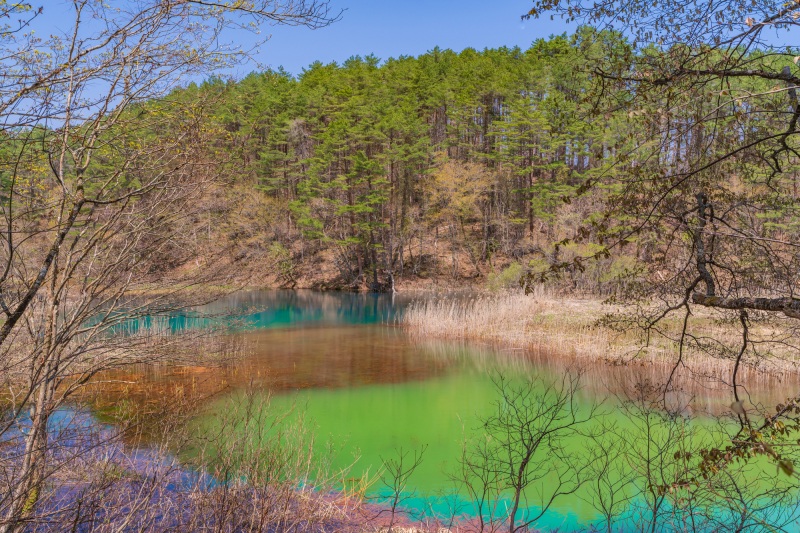
[Fukushima Prefecture] Goshikinuma Nature Trail (Goshikinuma Shizen Tanshoro)
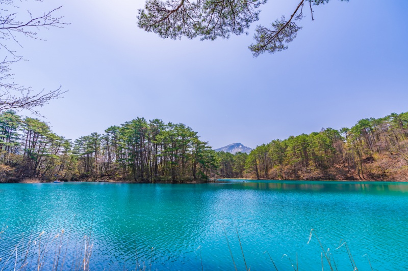
Mt. Bandai, one of the 100 most famous mountains in Japan, offers a spectacular view of Lake Inawashiro and the Azuma mountain range.
Goshikinuma Nature Trail is relatively flat and easy for beginners to enjoy. Its hiking course covers a total distance of 3.6 km and takes about one hour and ten minutes to visit eight of the Goshikinuma lakes and marshes that represent Mt. Bandai.
The color of the lake changes delicately depending on the season, weather, time, and angle of view. No matter when you visit, you will never get tired of seeing the beauty of these myriad changes.
Discover Different-Colored Marshes
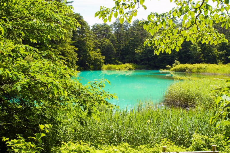
Goshikinuma is called the “Five-Color Marsh” not because it has five marshes, but because of the variety of colors that can be seen there. Emerald green, cobalt blue, turquoise blue, and so on, each time you walk through it, you will see different colors, making it look like a “mystery lake”.
The colors vary depending on the weather, the season, the time of day, and the angle from which you look at it, so you can see a different view every time you visit. It is said that the colors in each marsh change due to differences in the volcanic minerals contained in the water, underwater plants, and changes in the refractive index of light.
How Goshikinuma Came To Be
Goshikinuma—and hundreds of other lakes and marshes in Urabandai—were formed by the eruption of Mt. Bandai in 1888. The beautiful landscape we see today was created not only by the power of such explosive nature, but also by the tree-planting and other conservationist efforts of our ancestors.
The dozens of these lakes and marshes are collectively known as the "Goshikinuma Lakes and Marshes".
Bishamonnuma: The Largest and Most Exciting of the Goshikinuma Marshes
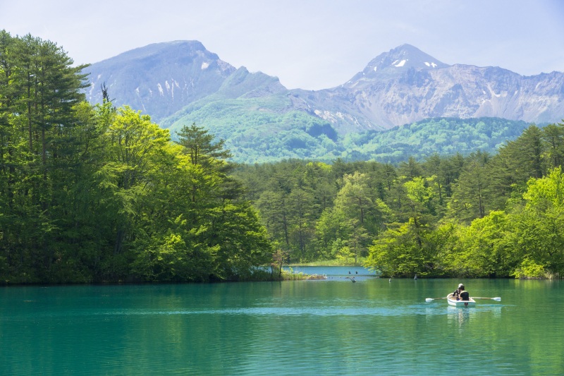
Starting from the Goshikinuma Entrance bus stop, a 10-minute walk will bring you to Bishamonnuma, the largest marsh in Goshikinuma.
With the beautiful ridges of Mt. Bandai towering directly in front of you, it is said to be the most beautiful place among all the Goshikinuma lakes and marshes. Renting a boat and rowing on the lake to really experience the clear water and beautiful scenery is a popular activity. Boats can be rented for 30-minute intervals.
Column
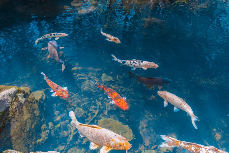
Legend of Bishamonnuma: The "Heart-Marked Carp"
The lake is so clear that you can see the bottom as well as colorful carp swim in the water. Among them, there is a carp with a red heart on its body. The legend of Bishamonnuma is that if you meet it, your wish will be fulfilled. Try to find them by renting a boat!
[Niigata Prefecture] Ōnogame
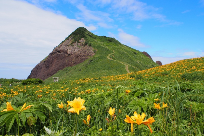
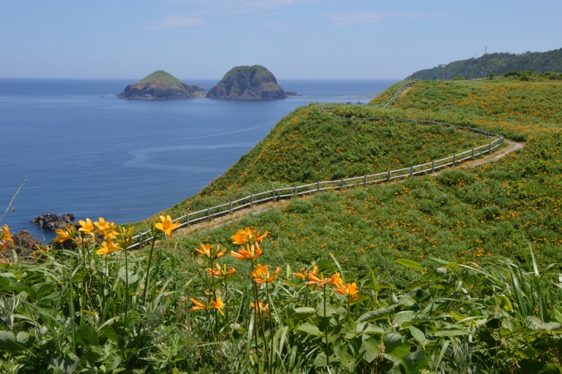
At the northern tip of Sado Island is a small mountain jutting out into the Sea of Japan. This mountain is called “Ōnogame” and looks like a turtle, but it is actually a huge monolith. It is also famous as a place where the Tobishimakanzō flowers grow in clusters, which are at their best from late May to early June. The contrast between the yellow carpet covering the mountain and the blue of the sky is breathtaking.
A walking trail leads to the top of the rocks and takes about 30 minutes to climb.
During the walk, you can see two islands collectively called “Futatsugame” (Two Turtles) since they look like two turtles huddled together. Enjoy the scenery of the Sea of Japan as it changes with the rising of falling of the tides. The clarity of the water around Ōnogame is the best in Sado Island.
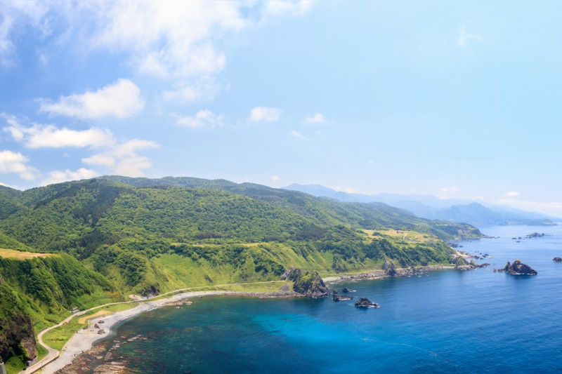
Once you reach the top, you will have a panoramic view of “Soto Kaifu”, the northern coast of Sado. The sheer coastline and the horizon spread out before you. The panorama of nature is overwhelming. With the most dynamic scenery and crystal-clear waters of Sado, the untouched wilderness feels very powerful. The sunset over the Sea of Japan is so beautiful that you will never get tired of watching it.
Tobishimakanzō: Orange as Far as the Eye Can See
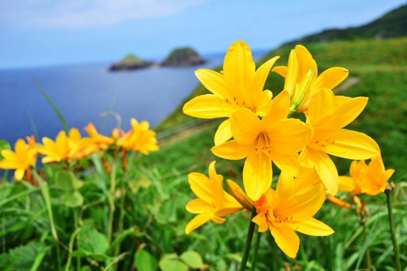
Tobishimakanzō is a yellow flower of the lily family that, outside of Sado Island, can only be seen in parts of Yamagata Prefecture.
The best time to see it is from late May to early June, when it fills Ōnogame with yellow. The contrast between the entire area dyed yellow and the clear blue sky is truly spectacular.
On Sado Island, the Tobishimakanzō is called “Yōrame”. The “yō” in “Yōrame” refers to fish, and “rame” refers to fishes’ eggs. It is said that "When this flower blooms, the sea and the fish will come alive”, so the area is carefully protected by locals.
Column
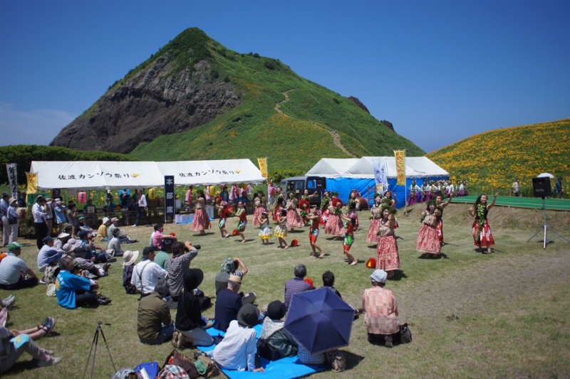
Local Entertainment with Tobishimakanzō in the Background
Due to its historical background, Sado has seen an influx of various cultures—such as aristocratic, samurai, and merchant cultures—resulting in the flourishing of a rich and varied tradition of performing arts.
At the Sado Kanzō Festival, held during the best time of year for viewing Tobishimakanzō flowers, visitors can enjoy a number of local performing arts such as Kaifu Taiko and Sado folk songs against the backdrop of a carpet of yellow-blooming Tobishimakanzō.
On the eve of the festival, lanterns are lit up and the “Ondeko” drums are lit by bonfires, an altogether different atmosphere from the daytime.
■ Samidare no Nagare (Samidare Stream)
This is the closest viewpoint from Yakeyama and boasts an abundance of water due to the confluence of three mountain streams. The rocks scattered throughout the area create multiple streams, making for a dynamic and beautiful view. It is also famous for its beautiful azaleas that bloom in spring.